I need your help to identify the buildings and locations in a small selection of early cartes-de-visite photographs which are mostly of Whanganui. These photographs were taken by William Harding who operated a long running photographic studio in the city in the second half of the 19th century.
Some of these buildings may no longer exist but if you know them and are able to help please mention the photograph number in the comment section at the bottom of this blog post.
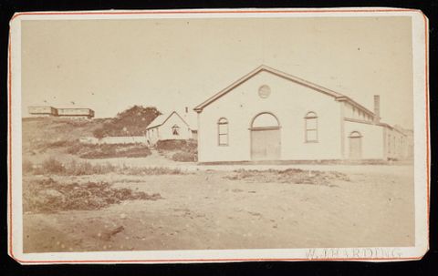
1. Lovely curves on this building…
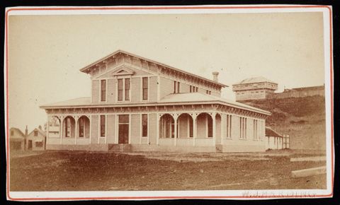
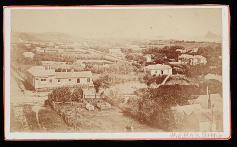
2. Large two storey wooden building …
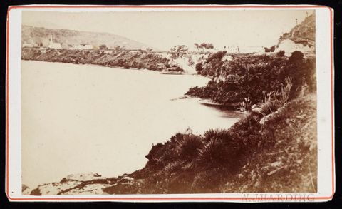
3. Near Whanganui?
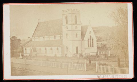
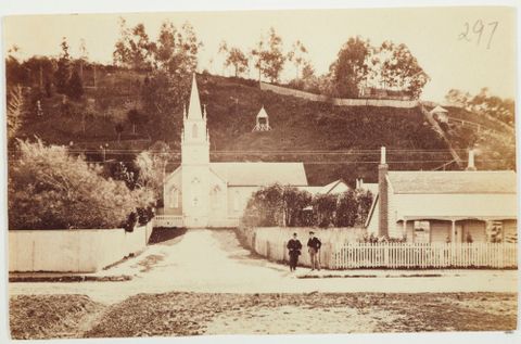
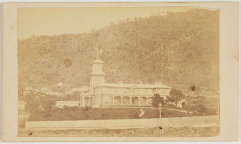
4. In Whanganui?
5. In Taranaki somewhere?
6. No idea for this one…
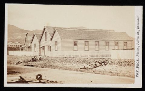
7. A wharf side branch of the Bank of Australasia…

8. The photographers were based in Thames – is this Thames as well?
9. Could be a busy street these days…
10. Not the current Government House in Wellington…
Please comment in the section below – and many thanks for your help.
Also check out the feature on the Whanganui River in Nga Toi Arts Te Papa.
Lissa Mitchell – Curator Historical Documentary Photography
Curator Historical Documentary Photography
Follow Lissa on Twitter: @rainyslip
No.6 is Napier Presbyterian, I think.
No.9 is certainly still in Ponsonby Rd and is either Presbyterian or Methodist.
No.7 is 99-101 Customhouse Quay, Wellington, before further reclamation of the harbour. The wharf was called “Waterman’s Steps” and pulled up is one of the ferry boats which took passengers, likely to and from Petone.
Good to see many of your queries have been answered Lissa. No 9 is a church on Ponsonby Road in Auckland. Not sure which denomination, but I think it’s a Samoan place now. It’s almost opposite Richard Toy’s Anglican All Saints
No 4 has already been identified, but there’s another photo of it, taken in 1905 from the other side, on my website. My grandparents were married there: http://viviennemorrell.wordpress.com/2014/10/23/a-new-zealand-edwardian-photo-album/
Thank you for sharing your personal connection to the church Vivienne
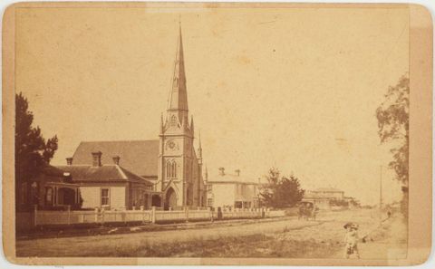
No.’s 6 to 9 could be anywhere in NZ – who knows?
No leads yet on numbers 5, 6, 7, 8, & 9. No. 5 is probably in the Manawatu/Taranaki area (being as it is also by Harding).
#4. Christ’s Church, Wanganui http://www.aucklandcity.govt.nz/dbtw-wpd/exec/dbtwpub.dll?BU=http%3A%2F%2Fwww.aucklandcity.govt.nz%2Fdbtw-wpd%2FHeritageImages%2Findex.htm&AC=QBE_QUERY&TN=heritageimages&QF0=ID&NP=2&RF=HIORecordSearch&MR=5&QI0=%3D%224-6536%22
#8. Looks like Thames School of Mines – almost
Thanks for your comment Rachel and the link too
No1 Is the Garrison Hall with the Goal behind it and the Rutland Stockade on the hill.
No2 is the old Court House in Whanganui with the Rutland Stockade behind it.
No3 is Upokongaro up the Whanganui River, with St Mary’s Church on the left of the view.
No4 is the Church of England situated on Lower Victoria Avenue in Central Whanganui, now relocated to St Peter’s Anglican Church in Koromiko Road, Gonville, Whanganui.
Not sure about the others, I can’t match them to any held in our collection here (Whanganui Regional Museum).
Thank you Sandi – really appreciate this and also the details about the buildings too. Do these buildings still exist?
Number 3 looks a lot like it’s Upokongaro, on the Whanganui River (a more recent image here: http://collections.tepapa.govt.nz/Object/712414).
Thanks Milly – a good example to send to me to as well!
Government house is on the site of the Beehive
Hi Brett – expect you mean the old government house? i’ll have a look for pictures of it and see if matches. cheers!
another picture in National Library: bit.ly/1sY3qjq
turns out it was the 2nd Govt House :
https://gg.govt.nz/content/other-government-houses
bit.ly/1sY3qjq
and pretty sure Photo number 2 is Whanganui’s first Court House which was in Motua Gardens
Photo number 4: (the church) http://wanganuilibrary.recollect.co.nz/nodes/view/108
as it is today in Koromiko Road: http://wn.anglican.org.nz/parishes___churches/wanganui_plateau/st_peter_s__gonville__wanganui
Awesome – thanks Rachael!